Spring Bass Fishing with Deep Dive's Streamflow Map
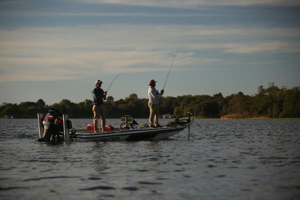
Spring has sprung, and for bass anglers, that means one thing: change. Water temperatures are rising, bass are moving shallow to spawn, and the dynamics of our lakes and rivers are in constant flux. One of the most crucial pieces of information you can have during this transitional period is understanding streamflow.
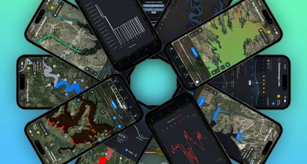
In the Deep Dive app, we've integrated a powerful Streamflow map layer, pulling near real-time data from NOAA's National Water Model. This feature provides you with a visual representation of stream and river flows across the US, with 2 days of historical data and a 7-day forecast. But how can you use this information to put more bass in the boat this spring? Let's dive in.
Why Streamflow Matters in the Spring
Spring is a time of significant water movement. Snowmelt, spring rains, and dam management all contribute to changes in the flow rates of the streams and rivers that feed our lakes. These changes have a direct impact on bass behavior:
- Oxygenation: Increased flow often means higher levels of dissolved oxygen in the water, which can attract active and feeding bass.
- Nutrient Delivery: Incoming water carries nutrients and baitfish, creating feeding opportunities for bass, especially near stream mouths and inflows.
- Spawning Habitat: Stable or receding flows can be crucial for bass that are preparing to spawn in the backs of creeks and shallow areas influenced by incoming water.
- Water Clarity: Spring runoff can bring in sediment, affecting water clarity. Understanding where clearer or dirtier water is entering a lake can help you target bass that prefer specific conditions.
- Temperature Changes: Warmer inflows can attract bass seeking warmer water in the early spring, while significant cold water releases can temporarily push fish out of an area.
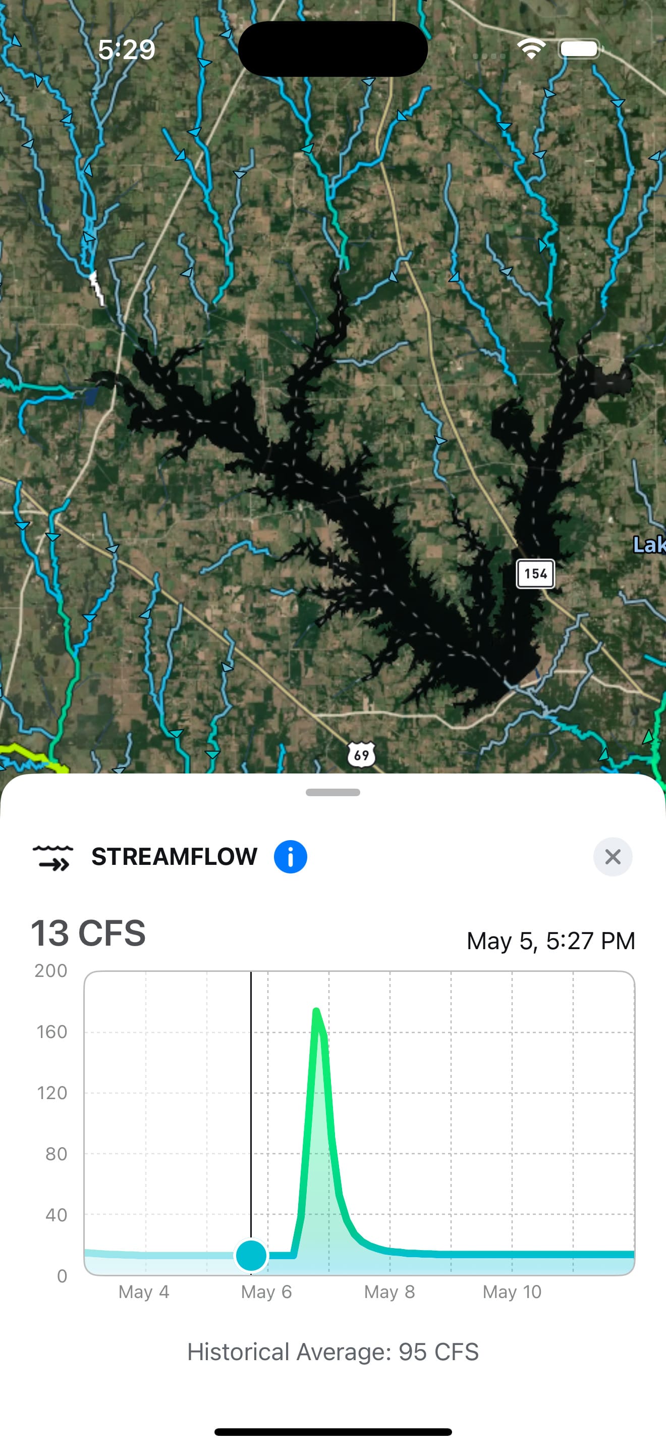
Decoding the Deep Dive Streamflow Map
Our Streamflow map is designed to give you a clear and actionable understanding of what's happening beneath the surface:
- Color-Coded Streams: At a glance, you can see the relative flow rates of different streams. This helps you quickly identify areas with significant water movement.
- Timeline Navigation: Scroll through the 7-day forecast to anticipate changes in flow. This allows you to plan your fishing trips around optimal conditions. For example, if you see a predicted increase in flow into a certain creek arm, you might plan to fish the mouth of that creek in the following days.
- Detailed Flow Graphs: Tap on any stream or river on the map to access a detailed graph showing the flow rate for the past 2 days and the 7-day forecast. This provides precise data to help you understand the magnitude and direction of flow changes.
Spring Fishing Strategies Using Streamflow
Here are some ways to leverage the Streamflow map this spring:
- Target Inflows During Stable or Increasing Flows: When streamflow is stable or on the rise, it often brings in a fresh supply of oxygen, nutrients, and baitfish, which can be a magnet for actively feeding bass. Use the Streamflow map to pinpoint these inflow locations, which are often further highlighted by our Water Inflows map layer. Pay close attention to the 7-day flow forecast. For instance, if you observe a creek maintaining a consistent flow into the main lake, the areas around its mouth – such as points, submerged timber, or channel swings – could be prime targets.
- Monitor for Flow Reductions Before Spawning: As bass stage in the backs of creeks and shallow areas in preparation for spawning, stable or slowly receding flows can be ideal conditions. Keep an eye on the 7-day forecast for streams feeding these potential spawning grounds that show a trend of decreasing flow. For example, if a smaller creek exhibits a gradual reduction in flow, the shallow flats and vegetation within its backwaters might become highly attractive spawning locations.
- Find Cleaner Water Above Muddy Inflows: Spring rains can lead to some feeder streams carrying muddy water into the lake. By using the Streamflow map in conjunction with our Water Clarity map, you can identify areas where streams with lower or more stable flows might be introducing clearer water to adjacent parts of the lake. Consider a scenario where a major river inflow shows high flow and dirty water; in this case, look for smaller streams nearby with consistent, lower flows that could be providing clearer water refuge for bass.
- Anticipate Bite Changes with Rapid Flow Fluctuations: Sudden increases or decreases in streamflow can significantly impact bass behavior. A rapid increase might scatter fish or push them tighter to cover, while a quick decrease could concentrate them in specific areas. Utilize the 7-day forecast to anticipate these changes and adjust your fishing approach accordingly. For instance, if a significant dam release is predicted to increase flow in the lower end of the lake, be prepared to target bass holding tight to structure or in eddies to escape the stronger current.
Spring bass fishing is all about understanding and adapting to change. By utilizing the Streamflow map in the Deep Dive app, you gain a significant advantage in predicting bass behavior and putting yourself in the right place at the right time. So, as the waters warm and the bass begin their annual rituals, let Deep Dive be your guide to unlocking the secrets of streamflow and having your best spring fishing season yet!