Deep Dive Introduces Recent Satellite Imagery for Lakes

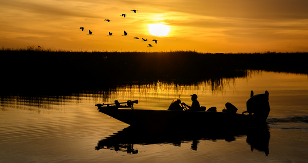
As most bass anglers know, satellite imagery is a highly effective fish-finding tool. Using Google Earth to scroll back through historical images during periods of low water or super-clear water can certainly reveal hidden gems of contours and cover.
The Problem with Outdated Satellite Imagery
While Google Earth is great for historical satellite images from years gone by, it does not provide current captures of lakes. Anyone who has scoured Google Earth for any length of time eventually comes to the same thought: I wish they had recent satellite images so I can see what’s happening now.
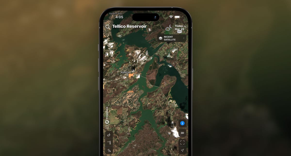
The Deep Dive app has recently fulfilled those wishes for more timely satellite secrets with the addition of the groundbreaking “Recent Satellite” feature. Recent Satellite provides updated satellite imagery across the continental United States every three to five days, providing anglers with an up-to-date bird’s eye view of America’s lakes, rivers, and coastal areas.
What You Can See with Recent Satellite Lake Maps
The power of this new feature is an angler’s dream come true for closely examining a multitude of critical variables across a fishery, including:
- Water clarity
- Sneaky water inflows
- Water color mixes from current and wind
- Current seams in tailrace areas
- The presence of different forms of cover
- Changes in vegetation growth
- Current water levels in fluctuating reservoirs.
- Backwater ponds, oxbows, and newly flooded areas during high-water periods.
The amount of information that can be derived from just one current satellite image is immeasurable when it comes to breaking down a lake quickly. Scrolling from lake to lake, and even across coastal areas, can be done in a matter of seconds. Zooming in to inspect water color mixes, various types of cover, water levels, and vegetation growth is a huge benefit. But as with all satellite imagery, cloud cover and atmospheric conditions can, at times, hinder resolution.
How Pros Use Recent Satellite Imagery to Catch More Fish
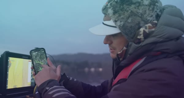
Deep Dive unveiled the Recent Satellite feature on March 11, one day before the start of the 2026 Bassmaster Classic on Fort Loudoun and Tellico Lakes. Bassmaster Elite Series pro Jordan Lee wanted to put the new feature through the paces during the Classic.
“I decided to approach this Classic with a more traditional fishing mindset,” said Lee, who is a two-time Classic winner. “In doing so, I purposely fished shallow. I used Deep Dive’s new Recent Satellite feature to see how the muddier water was tracking down the lake.”
Specifically, Lee targeted subtle water color changes occurring at the mouths of creeks and pockets along the river. He noted that the best water color changes were so slight, he couldn’t notice them while running and looking.
“I really got on that pattern the second day,” Lee added. “Wherever the satellite image indicated a slight water color change, I stopped and fished. Once I got dialed in, I could pinpoint the faintest change in water color with my eyes, and fish just that tiny window and then move on to find the next one.”
Lee’s increased efficiency of fishing only the highest-percentage water helped him catch better-quality fish, pushing his day-two catch to nearly 21 pounds, and earning him an 8th-place finish in the Classic.
“Since then, I have become obsessed with looking at the Recent Satellite images on lakes across the country,” he said. “It’s amazing to have those kinds of up-to-date views of any lake you want to see, right in your hand.
This week, Lee is again leaning on the Recent Satellite images to help him navigate the lengthy Tennessee-Tombigbee Waterway for the third Bassmaster Elite Series of 2026.
“The most recent image from Deep Dive was from March 22,” Lee says. “It’s already been a big help in deciphering water color movement throughout this whole system.”
Deep Dive’s mission to arm today’s angler with the most up-to-date information on critical fishing conditions continues to grow with the addition of Recent Satellite imagery. The range of conditions now monitored by Deep Dive includes weather, wind, waves, water levels, water color, dam outflows, generation schedules, stream flow rates, tides, and now satellite images every three to five days – all in one app.