Outsmart Rough Waters: How Deep Dive’s Wind Effects Map Saves Your Day

How many times has the wind caught you off guard? Everything was fine in the morning, but by afternoon, you found yourself in a real bind.
As anglers, we have all been there. The hour-long run in the morning only took 53 minutes across smooth, glossy waters against a beautiful sunrise.
However, at 1 p.m., the conditions are different – much different. Time to start calculating run-back math.
The wind reached its forecasted potential of 10 to 15 mph two hours ago and has now added another 5 to 10 mph into the equation. The wind direction is not exactly out of the northwest like it was predicted to be, either. Judging from the wicked flap of a few flags planted around the protected bay you’ve been fishing all morning, the wind direction looks to be more of a straight north, howling right down the gullet of Lake Champlain, or Toledo Bend, or Kentucky Lake – or any of the other massive lakes that lie north to south. So much for the plan of hugging the west bank for protection on the ride back to weigh-in.
Now the brain begins to do the “rough” math calculations to get back. An hour and 30 minutes for the ride back? Two hours? Two and half hours? Don’t want to leave too early; every minute spent fishing this calmer bay is a chance to cull up.
Is there any west in the wind at all? How hard is it really blowing anyway? Where should I cut across the main body of the lake to switch sides?
So many questions.
Maybe pulling out the phone and cross-checking a few wind apps might help this conundrum. This reveals that the wind is from the North at 18 mph. And it’s hard to tell from the “wind arrows” exactly which side of the lake would be best to run going back.
Right back to square one.
Why Standard Wind Reports Fall Short on Big Lakes
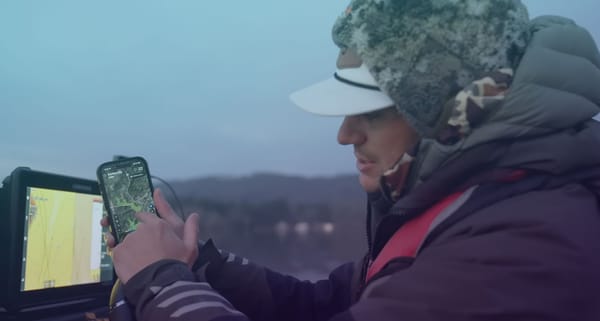
To clear this matter up faster, a better idea would be to check the Deep Dive app and its Wind Effects map to get a much clearer view of how the wind is truly impacting the lake.
This tool was created to help anglers find the exact amount of wind they want for catching bass. However, the Wind Effects tool also doubles as a terrific navigation aid in tricky winds, especially if little experience on the lake factors into the equation. By turning on the “Calm” and “Waves and Banks” layers, it gives the user a much more accurate idea of where the calmer ride back exists.
The truth is, a generic wind direction, such as north at 18 mph, can vary up to 15 to 20 degrees each side of north. And the speed of the wind can fluctuate up to 5 to 10 mph. That’s a lot of variation that can lead to some sure enough rough math when it comes to navigating big lakes.
How Deep Dive Maps Real Wind Effects
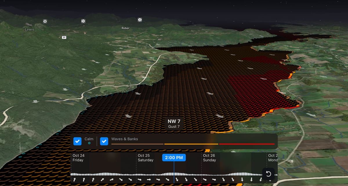
Deep Dive is far better for deciphering wind effects because it provides a high-resolution look at wind, with much better detail of how the wind interacts with water and bank lines. The Wind Effects map uses algorithms that constantly interpolate the wind direction, speed, fetch, and bank relief to provide a color-coded graphic representation of the waves’ intensity and how they are moving across a lake.
This allows the user to see exact wind shadows along leeward banks, bays, and behind islands to know where the calmer water is, and how far it extends offshore. The ability to see how far a wind shadow reaches off the bank is huge in making decisions about which side of a lake to run and when to swap sides for better protection.
If a reservoir lies north to south and the wind is out of the west, then obviously the western bank provides the best running conditions. However, in situations where those same lakes have north or south winds, knowing exactly how much east or west is in that “north” wind becomes critical information that can’t really be determined through traditional wind reports or arrows. The slightest change in the angle of the wind can produce a completely different outcome than what was expected.
Navigating Safely with the Wind Effects Tool
The Wind Effects tool is also a true gem when choosing the most comfortable course across a large body of wind-swept water. As most experienced anglers know, “running in the troughs” and staying parallel with the waves, is faster and more comfortable in big water. But since staying in troughs requires running mostly in a straight line, you have to make sure your destination point lines up with the waves when you begin your crossing.
Deep Dive’s graphic depiction of the wave angles across the lake gives the user a much better idea of where the best “lines” are to cross a lake to stay in the troughs all the way across. It might not always be the straightest line across, but it will be the most comfortable and best line for protecting your gear.
Deep Dive uses this same wave-depiction technology when producing a wind forecast for up to 7 days. This is a huge help when looking to the days ahead to see where the calmest routes are going to be with shifting winds.
Now you don’t have to do the rough math for rough waters anymore. If long runs on big lakes are on your schedule this year, let Deep Dive remove the guesswork and give you the smoothest ride possible.