Expanded Tidal Support

Hey Deep Divers!
Get ready to unlock even more potential on the water. We've just released a major update to our advanced Tides feature, bringing our super-accurate tidal forecasts to some seriously popular fisheries!
You already know how crucial tides can be for bass fishing in tidal waters. Figuring out those peak feeding windows around high and low tide or knowing how the water is moving in a specific spot can make all the difference. But let's be honest: Finding reliable, detailed tidal data that's easy to use has been a pain—until now.
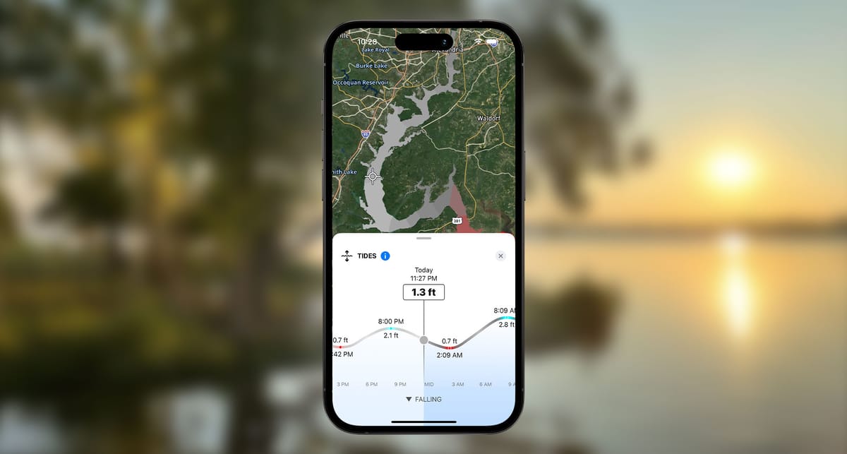
Our Tides feature is powered by advanced NOAA data, meaning it goes way beyond basic lunar charts. It factors in things like weather and the shape of the waterway to give you the most precise forecast possible. You can tap anywhere on the tides map and see the exact high and low tide times and heights for that specific spot—perfect for dialing in on those key areas.
And the best part? We've just expanded this game-changing feature to cover these important rivers:
- Potomac River
- Rappahannock River
- York River
- James River
- Sabine River
- Neches River
- St. Johns River
Whether you fish the expansive tidal systems of the Chesapeake Bay area or the unique conditions of the Sabine and Neches, you now have access to Deep Dive's best-in-class tidal data to help you plan your trips and find more fish. (We previously added the St. Johns, and we're excited to have these new ones join the list!)
This is another step in our mission to give you the most advanced fishing data right at your fingertips. By combining detailed tidal forecasts with all the other powerful layers in Deep Dive—like Water Clarity, Wind Effects, Streamflow, and more—you get an unparalleled understanding of what the fish are doing and where to find them.
Make sure your Deep Dive app is updated to the latest version to get immediate access to this expanded Tides feature. We can't wait to see how it helps you catch more bass on these incredible tidal fisheries!