Dialing in Deep Dive’s different dimensions

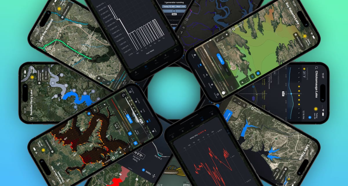
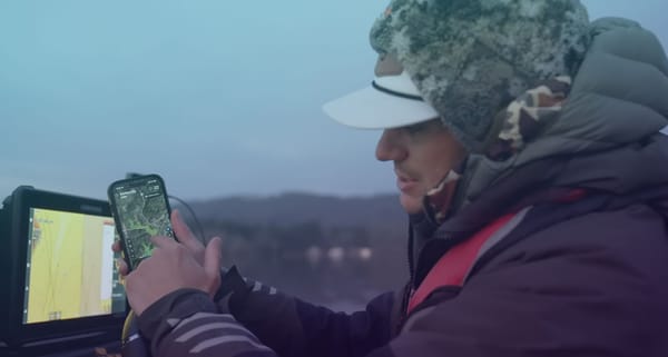
The Deep Dive app’s list of pro features, which helps anglers of all levels catch more fish on popular public lakes, has now grown to twelve different possible channels of information. All twelve channels are not available for every lake included on Deep Dive, but some lakes will have as many as ten to eleven channels to view.
With differing dimensions of data to choose from, some wonder which Deep Dive features to use when.
For starters, it’s important to understand that nine of the twelve channels are derived from real-time data sources. These include five conditions that should be considered any time you go fishing: Weather, Lake Level, Water Clarity, Wind Effects, and Streamflow.
Beyond those variables, it depends on what kind of fishery you’re dealing with. If you are fishing a tidal basin like the Potomac or St. Johns Rivers, then the Tides map is a huge plus. If you are on a highland impoundment, the Water Inflows map is a big help. Visit any TVA or Alabama Power Lake, and the Outflow History and Generational Releases tools become critical players.
Having access to this many real-time conditions at your fingertips is a tremendous advantage in efficiency. To find this same data for all the conditions listed above would require a significant amount of research, including visiting at least five different websites or apps that would change with differing lakes. Deep Dive provides it all in one place.
In addition, most of the real-time functions provide a brief history and a futurecast of the condition, so you can determine how much change is taking place for that particular condition.
Apart from the nine real-time conditions, Deep Dive offers three other channels of information: the Bait Tool, the Best Areas map, and the Patterns map. The information for these functions is derived from thousands of data points produced during tournaments held on the particular lake you are viewing. These provide a longer historical context of traditional lures, areas, covers, and structures that have been proven performers over time. In order to search any one of these three databases, the user must provide six critical details from the conditions picker. Those details include the season (based on water temperature), depth (shallow or offshore), wind level (wind-protected or wind-blown), the presence of aquatic vegetation, the species of bass being pursued, and the lake level (high, normal, low). These parameters help search Deep Dive’s vast database for suggestions. Changing the condition parameters for a lake will cause a change in the suggestions.
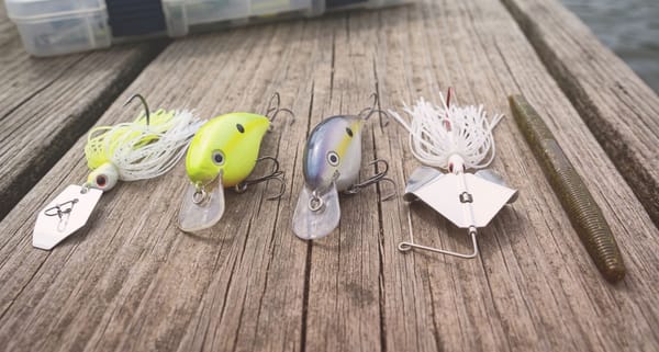
The Bait Tool is designed to offer several proven lures to consider, ranked in order of effectiveness. To dial in the recommended colors of those baits, choose a water color (clear, stained, muddy) and the time of day (sunrise, morning, afternoon, sunset). By clicking on each bait suggestion, Deep Dive provides a library of photos of the best cover and structure to fish the bait. In addition, it recommends the proper equipment (rod, reel, line) as well as a video demonstrating how to work the bait effectively.
The Best Areas map requires condition inputs as well and provides areas or sections (shaded in blue) that have been historically productive.
The Tournament Patterns map is a blend of the Best Areas map and the Bait Tool, allowing the user to see everything at one time: the best lures that worked in the best areas, with pictures and illustrations depicting examples of the best contours, structures, and cover.
Used together, these three tools are all excellent resources to get an idea of what kinds of lures and actions have been proven to work in what areas and on what cover and structure on a particular lake. They help paint a better picture of the lake’s baseline characteristics. Is the lake more spinning rod-oriented or casting rod-oriented? Is it more of hard bait lake or a soft-plastic lake? Is the productive water more on the main lake body or in multiple creeks and pockets?
With nine different real-time functions for current conditions and three tools providing historical context for lures, areas, and patterns, Deep-Dive is the one-stop app for dialing in different dimensions of a lake in minutes. To keep up with the growing list of lakes and features for each fishery state by state, click here. https://deepdiveapp.com/lakes