Deep Dive's Guide to Success in the Dog Days of Summer

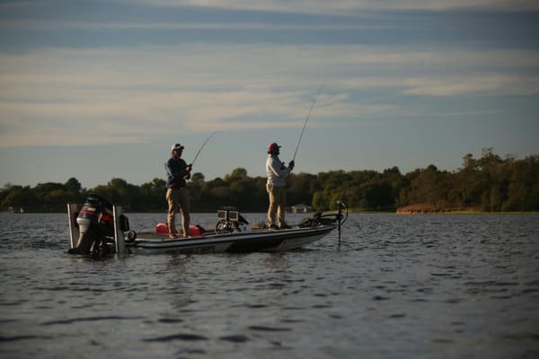
Summer is here, and for bass anglers, that means long days on the water and the potential for some of the most explosive fishing of the year. But summer also brings its own set of challenges. Hot, sunny conditions can make bass lethargic and send them seeking refuge in deeper, cooler water or tucked into the thickest cover. Finding and catching them requires a smart, data-driven approach.
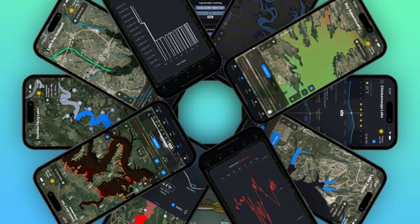
This is where the Deep Dive app transforms your summer fishing trips. Instead of guessing, you can use the most advanced data available to pinpoint exactly where the bass are and what they’re biting. Let's break down how to prepare for your next summer fishing adventure using the powerful features of Deep Dive.
Monitor Lake Conditions in Real-Time
Summer weather is dynamic, and lake conditions can change in a flash. Staying on top of these changes is crucial for locating active fish.
- Lake Level & Discharge: Summer often brings fluctuating water levels due to increased water demand and power generation. With Deep Dive, you can effortlessly track recent lake level data and dam discharge (labeled as "Current Flow") for a vast number of lakes where the data is available. This information helps you understand if the water is rising or falling. Falling water can pull fish out of shallow cover and position them on the first available drop-off, while rising water might push them into newly flooded vegetation.
- Weather and Solunar Data: Our 7-day forecast gives you more than just the temperature. You get critical angling information like wind speed and direction, barometric pressure, and sky conditions. Combine this with our detailed solunar data, which shows you the major and minor feeding windows for the next week, and you can plan your trips for the most active feeding times, like early morning or during a major solunar window.
Pinpoint Productive Areas with Advanced Map Layers
The key to summer bass fishing is finding the three things fish need most: comfortable water temperatures, ample oxygen, and plenty of food. Deep Dive's revolutionary map layers take the guesswork out of this process.
- Wind Effects: Wind is an angler's best friend in the summer. It breaks up the surface, creates current, and pushes plankton, which attracts baitfish. Our one-of-a-kind Wind Effects map layer visualizes the impact of wind on the lake for the past two days and the next seven. See which banks are getting the most wave action, stirring up the food chain and creating a feeding frenzy. The historical data is key—a bank that has had a consistent wind blowing on it for 12-24 hours is a prime spot to investigate.
- Water Clarity: See the lake like never before with our daily satellite-derived water clarity maps. Summer heat can lead to algae blooms that drastically change water clarity. With Deep Dive, you can see these changes across the entire lake and even look back over the last 30 days. Found some fish in stained water? Use our filter tool to find similar water clarity in other parts of the lake, saving you hours of running and gunning.
- Water Inflows: Using the USGS National Hydrography Dataset, we've mapped out every stream and drain entering your favorite lakes. These inflows are hotspots for summer bass as they bring cooler, more oxygenated water into the lake, attracting baitfish and, consequently, hungry bass. What might look like an insignificant ditch on a satellite map could be a major fish-holding area, and Deep Dive makes it easy to find.
- Tournament Patterns: Want to know how the pros would attack your lake in the summer? Our Tournament Patterns feature projects real fish catches from professional tournaments onto a map of your lake. We filter our extensive database of tournament results by season and weather conditions to show you which sections of the lake—from the main lake to the back of creeks—are most productive in the summer and the patterns that are working.
- StreamFlow: For river and reservoir anglers, our StreamFlow map is a game-changer. Powered by NOAA's National Water Model, it shows you the flow rates for most streams and rivers in the US, with two days of history and a seven-day forecast. You can see how recent rains are affecting inflow currents or how dam generation is creating feeding opportunities, all in an easy-to-understand visual format.
- Tides: If you're fishing tidal waters, our advanced tide forecast is the most accurate available. It goes beyond simple lunar charts by incorporating a weather model and bathymetric data to give you a precise 2-day tidal forecast for any point on the map. Know the exact time of high and low tide in that backwater creek you want to fish.
The Ultimate Summer Bait Picker
Once you've found the fish, Deep Dive's Bait tab tells you exactly what to throw. By selecting the season (summer), your preferred fishing style, the presence of vegetation, and your target species, and combining that with the current weather conditions, we give you a list of top fishing strategies.
Each strategy includes:
- The best bait and color to use.
- The section of the lake to focus on.
- The specific cover and structure to target, with visual examples.
- A retrieve video and pro tips.
- Rod, reel, and line recommendations.
Whether you're faced with clear, stained, or dirty water, you'll have a proven plan for sunrise, morning, afternoon, and sunset.
This summer, don't just go fishing; go with a plan. Download the Deep Dive app for iOS and Android, and unlock the full potential of your favorite fisheries. It's time to beat the heat and make this your best summer of bass fishing yet.