Deep Dive Wind Effects: A Wave Forecast Like You've Never Seen
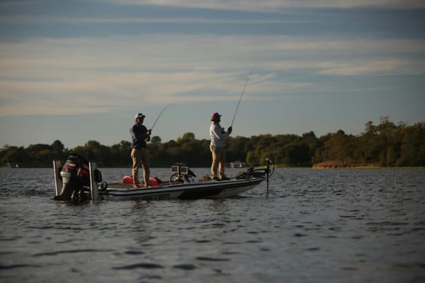
Every serious angler knows the mantra: “the wind is your friend.” It’s a piece of wisdom passed down through generations. But if we're being honest, some days the wind feels more like a bully than a buddy. It can turn a calm morning into a white-knuckled boat ride and make even the most promising spots unfishable.
What if you could know exactly how the wind was behaving all over the lake, not just from which direction it's blowing? A standard weather forecast tells you the wind speed and direction. But what does that really mean for the specific point you want to fish? Or the creek arm across the lake?
This is where simply knowing the forecast fails, and where visualizing the wind’s true impact on the water becomes a game-changer.
The Problem with a Standard Wind Forecast
A forecast that calls for a "15 mph southwest wind" gives you only a tiny piece of the puzzle. It doesn't tell you:
- Fetch: How far has that wind traveled uninterrupted across the water before it hits your spot? A 15-mph wind hitting a bank after traveling only 100 yards is vastly different from one that has blown across three miles of open water. The longer the fetch, the more energy is transferred to the water, creating more current and bigger waves.
- Accumulation: Has this been a consistent wind for the last 12-24 hours? The "magic" of a wind-blown bank doesn't happen in an instant. It takes time for the wind to stir up the water column, activate the plankton, draw in the baitfish, and, finally, attract the hungry bass. A standard forecast doesn't show you this history.
- Geography: How will that wind interact with the lake's unique layout? A southwest wind will be blocked by a bluff on one side of the lake, funneled down a creek arm, and smash directly into a main-lake point on the other.
A simple forecast number can't show you this complex, dynamic interaction. It gives you a variable, but not the full equation.
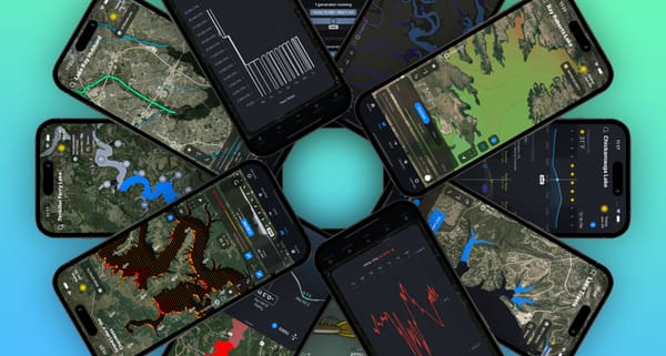
The Deep Dive Difference: Visualizing the Wind’s True Power
This is precisely why we built the Wind Effects map layer in the Deep Dive app. We didn’t want to just give you another wind forecast; we wanted to show you what that wind is doing.
Our system takes into account:
- Wind Fetch: We calculate the horizontal distance over which the wind blows across the lake's surface.
- Wind Speed & Direction: We use premium, hyperlocal weather data.
- Accumulation Over Time: We track how these factors build upon each other.
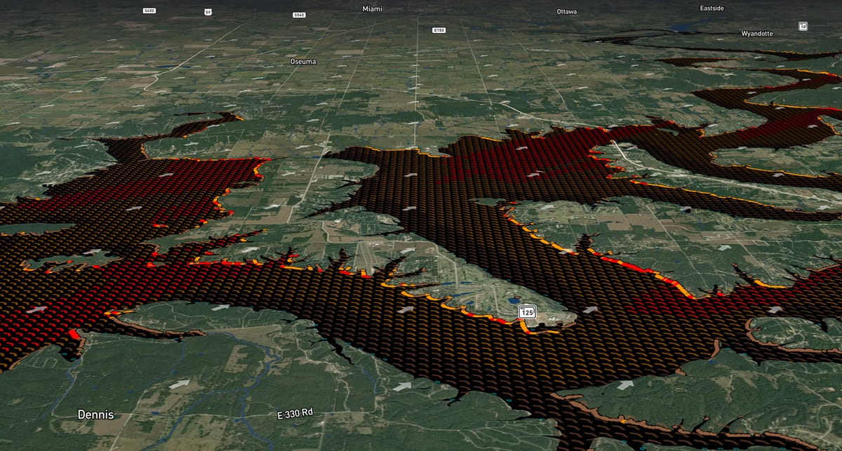
The result is a simple, color-coded map that anyone can understand instantly:
- Wave Icons: All over the lake, you'll see color-coded wave icons. Calm green icons show protected areas, while brown, yellow, and red icons show you the estimated wave sizes, from small chop to large, rolling waves. You can instantly see which parts of the lake are calm and which are rough without ever leaving the ramp.
- Bank Impact Dots: This is where the strategy comes alive. We display a series of dots around the shoreline showing you exactly where those waves are hitting the bank and at what angle. This visual cue is your guide to the most active feeding zones on the entire lake.
How to Turn Wind Data into a Winning Pattern
The Wind Effects map isn't just a weather tool; it's a strategic weapon.
- Look Back to Find the Bite: The food chain reaction on a wind-blown bank takes 12-24 hours. With Deep Dive, you can scroll back through the previous two days of wind history. Find a main-lake point or a flat that has had sustained yellow or red bank impact dots for the last day. That’s not just a spot; that’s a high-percentage target where baitfish have gathered, and bass are likely feeding.
- Look Forward to Plan Your Attack: Use the 7-day forecast to plan your next trip. See a consistent wind predicted for Saturday? You can identify the banks that will be most affected and build your entire game plan before you even hook up the boat. You’ll know which areas will be productive and which will be protected enough to fish safely and effectively.
Don't just guess where the wind is setting up a feeding pattern. Know.
The next time you look at a weather app and see "15 mph SW," open the Deep Dive app instead. See the red impact dots piling up on a series of points, look back and confirm it's been happening for a day, and head there with confidence. That’s the difference between just fishing, and fishing with a purpose.